I did a great "long" training run Saturday with friend Bob Rayburn. This time, on my turf. I'd been working on Bob to come up to my place to run long for awhile, and I told him a few weeks ago I have been training up around my place on terrain more akin to Arkansas than the Sanitas repeats of late. While I'm not knocking Sanitas at all (in fact, it's great hill work) it isn't exactly what you'll find at Arkansas, but I realize Bob was after other things for his training program for Arkansas. This was to be my first long run since Leadville a month and half ago, and my last long run before Arkansas just 2 weeks away.
Anyway, he agreed to come up and see what I have to run on by my place. While not as hilly and steep as Sanitas, it still has a lot of climbs, by our estimates around 4000' of elevation gain during the course of our trip. My plan was to start at my house (elev 6800') and head over to the farside of nearby Pinewood Reservoir, about 5 miles one way, then head back to the house for refilling of bottles and packs with food. Then we would head out west on Pole Hill Rd past the canal and bushwhack on a game trail to an old foresting road that takes us further west for about another 5 miles.
I've run this part many times, and came by it due to necessity. So a little background is in order (after all, it's MY blog, so I can say anything I want). Years ago, while building our house up here in rural Larimer County, I'd take time off to run on the dirt road (Pole Hill Rd) and see if I could get over to Estes Park. The local topo quadrangle maps shows Pole Hill going all the way to Hwy 36, dropping off just a few miles east and above Estes Park. Well, about 3.5 miles of the road is open, then you come to a metal fence with No Trespassing signs all over the place. At the time, I didn't think to much about it and went through and ran on the road all the way over to Hwy 36, then would run back. This was about 20 miles total distance. I did this for about 2 years, and would occasionally get stopped and questioned by the residents up there within the gated part (about 4 miles worth) as to why I'm up there, etc. After explaining I live on Pole Hill 5 miles east, they seemed okay with me being up there. One day, I was stopped by a totally irate resident threatening to call the cops on me for trespassing, yada yada. I tried to remain calm while he was screaming in my face. Even telling him I lived up there had no effect. Then I said, "Well, I see you are coming from the east. That means you had to drive on MY road, which I pay road maintenance fees to keep the road clear and graded. I know you guys don't pay into that, so don't tell me I have no right to be here. Besides, running on the road, which I am doing, has little impact on the road compared to driving. So go ahead and call the cops, I'm heading home now. Here's my name and phone number. Give them a call and have me hauled to jail!" And with that I just started back to running. Needless to say I never got a call from him or the cops. But this was a little stressful and I decided to try to find an alternative route around the road to avoid such confrontations. I want to run, not get hassled. Looking at the topo maps, talking to neighbors (who, by the way, have had the same thing happen to them by the "West Pole Hill" residents) I found an unimproved route just north, in National Forest, not on private property, that by passes the road. I'm still trying to find the end point to connect back to the road. But in all honesty, I haven't been up there in nearly a year and this run on Saturday puts the drive back in me to find the "Northwest Passage" to west Pole Hill where the public does have access (lots of trails and ATV routes). Maybe I can enlist the help of some running friends to spend a day up there to scout it out. Okay, enough on that.
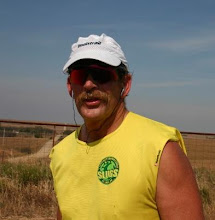
I went out first thing in the morning to stash a gallon of water at the trailhead junction (not really a trail, per se, but the game trail where we will turn onto from the road) and head back before Bob gets there. I get home and Bob is there talking with Lorraine, and he brought his dog Mabh, and our dogs (K-Dog, and the two Corgis) are having fun and playing. I get ready and explain to Bob the plan. Since K-Dog hasn't been on longer runs of late, I was only going to run with him on the first leg, which should be about 1.5 to 2 hours in length. He wanted to do the same with Mabh, and he would leave Mabh with Lorraine and the dogs while we went on our second half.
It was a bit nippy and decided on a longsleeve to start off with, knowing I'd take it off later in the run as it warms up. Bob did the same. We ran down our driveway and after 200 feet or so, Bob needed something he forgot, so we went back up to the house and started over. So we headed back down 400' on our driveway and turned left to head back up a perimeter road on our property that eventually turns into a neighbors driveway. I haven't been up here in nearly a year as he was building his place so I finally got to see his house. I decided rather than going up to his house and turning right onto the road that would take us to the reservoir, we bushwhacked a shortcut to the road. This is my favorite part of all this, as the road is varying from rocky, overgrown with tall grass, smooth, and alternating up and down. We finally get to the high part of the this segment at 7300' and bushwhack to yet another unimproved road (years ago there was a visible trail here so I knew where to go). We head down the rocky road and come the end of the Ramsey-Shockey Open Space trail that will take us over and along Pinewood to the farside. Now it's a really nice groomed trail that goes down to the reservoir shoreline. It's all runnable and we take advantage of it because as we head back later up to the ridge, it'll be an uphill grind. We stop a number of times to let the dogs jump in the water and cool off and drink. We finally get to the other side in about 55 minutes. I stop to use the outhouse and we head back. When we get to the west side Bob wants to take a side trail over to Fisherman's Cove to add a little more mileage in so we head over there, about .25 mile away. We get back to the trail junction and give the dogs one last chance to be dogs and swim, then we head up the trail to the ridge. We mostly walk, run some of the more gentler sections. Bob comments that this is a good uphill. We get to the top and I tell Bob lets take a little side trail off to the left, so we do and this adds about .5 to our run. We make our way back down and to the house, a total of 9.9 miles in 2:22, a little slower than usual but okay.
We let the dogs off, refuel, refill, and change clothes, and head west this time over towards the canal and the "Northwest Passage". Once on Pole Hill, the road gently rolls up and down, and to me, this is perfect Traveler terrain. After about a few miles, the road starts getting steeper. We go more into a walk mode here until after the canal and our turnoff. We stop and I refill my bottle before continuing on. Bob comments that was a long climb (about 3 miles). Well, we have more to do.
We make our way on a game trail that eventually takes us to the old logging road and we head up more. By this time, we are both getting tired but vow to continue on til 5 miles and turnaround. After about a mile, the terrain is less steep and we are able to run more. Finally, we get to miles (via our GPS) and turnaround and head back. We topped out at elevation 8500'. It's a good thing I stashed water cause we are both out by the time we get here. We stop to eat, refill bottles and take a short break. We empty the gallon of water, and not wanting to drive back up here I strap the empty jug to my waist pack belt and take it home with me.
It's all downhill from here, and we run most of it. We finally get to the bottom of our road (Lonewolf Road) which becomes my driveway .4 miles up. It's walk mode now as we climb the 300+ feet of elevation gain to the house.
So, 20.5 miles and we are done in 5:14:01. Bob commented he was surprised at the amount of climb but the terrain was great. Lorraine and I invited Bob for lunch and beer, and we had a great time relaxing, eating and having a few beers. A great way to end a long run!
So my last long run before the Traveler is done, now it's time to taper.
Subscribe to:
Post Comments (Atom)

1 comment:
Now that's what trail running is all about... count me in on your search for the "Northwest Passage".
Post a Comment